
Hurricane Franklin
Franklin, Could Become Atlantic Hurricane And Send Swells To U.S. East Coast.
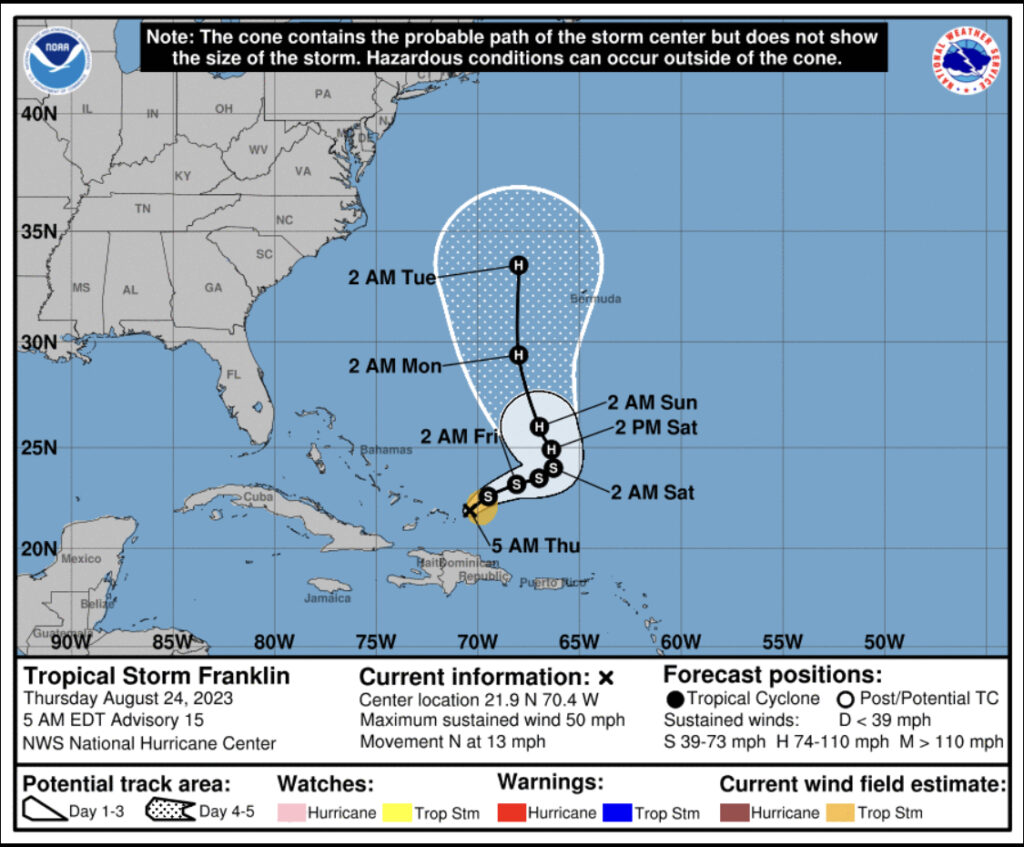
(8/24/23) Tropical Storm Franklin Discussion Number 15
NWS National Hurricane Center Miami FL AL082023 500 AM EDT Thu Aug 24 2023
Franklin is pulling away from the Dominican Republic and the Turks and Caicos, and appears to be gradually gaining strength. Satellite images show deep convection increasing near and to the east of the center, and the Air Force Hurricane Hunters reported that a partial eye-wall was developing on their last pass through the storm. The initial intensity of 45 kt is based on the earlier reconnaissance data and is also near the average of the various satellite intensity estimates. (Cangialosi)
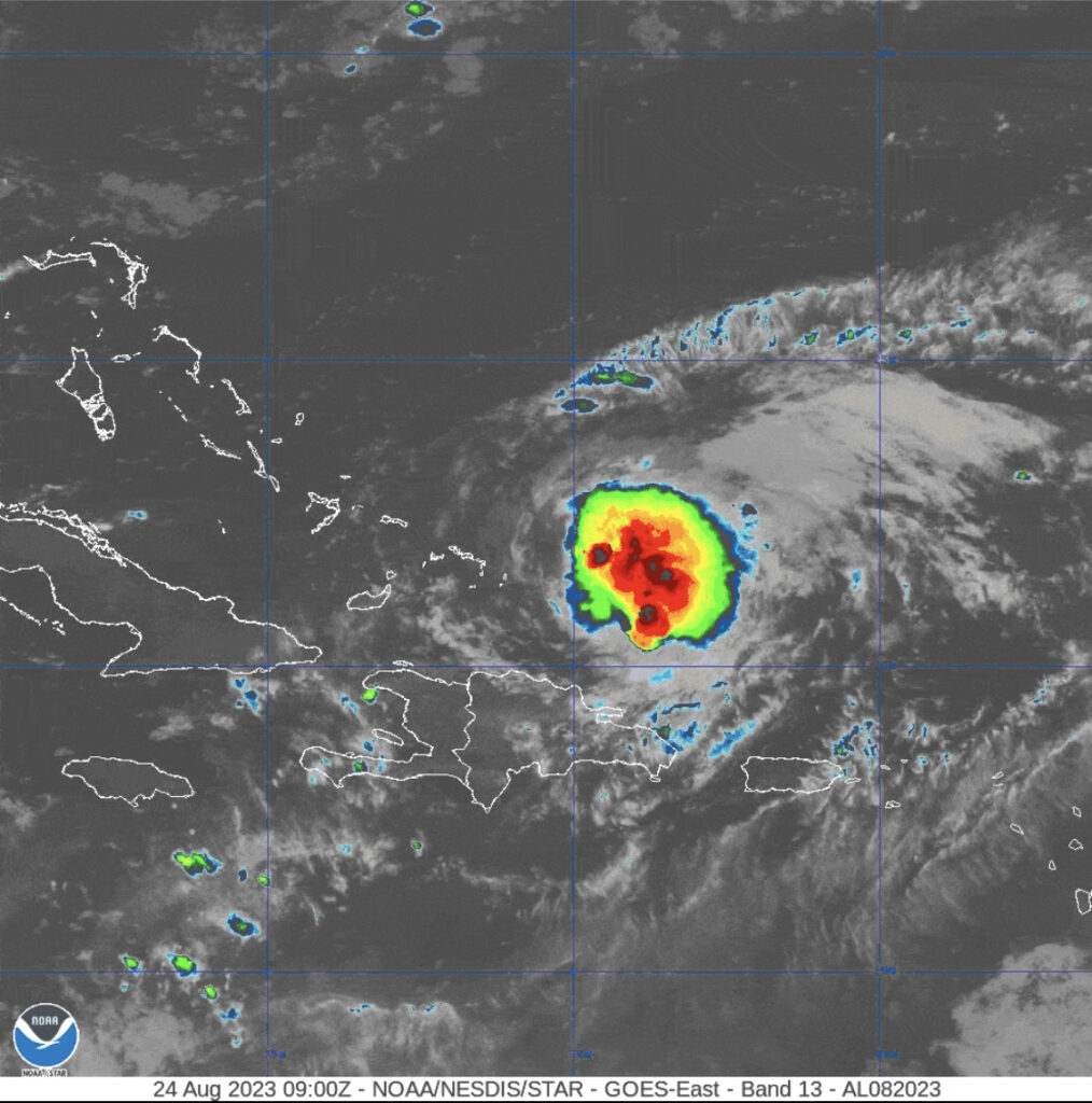
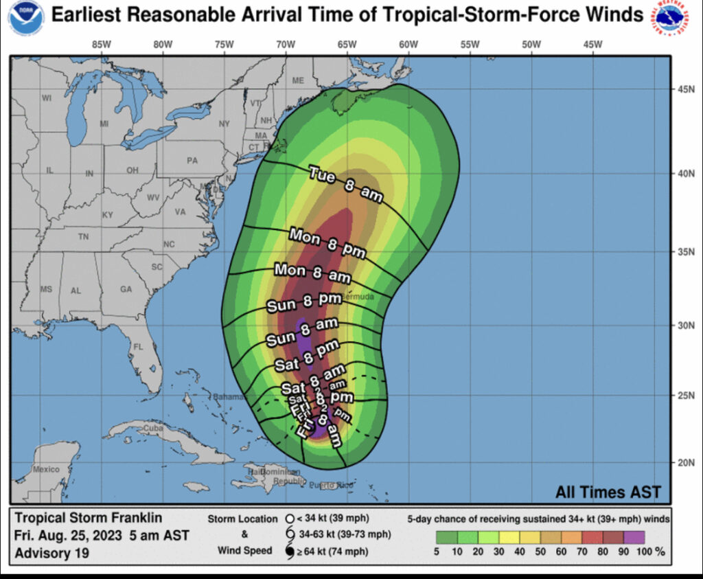
(8/25/23) Tropical Storm Franklin Discussion Number 19
NWS National Hurricane Center Miami FL AL082023 500 AM AST Fri Aug 25 2023
Franklin has generally changed little during the past several hours. The storm remains strongly sheared with the low-level center partially exposed near the western edge of the main area of deep convection. Cloud tops are quite cold on the system’s east side, but the storm continues to lack convective symmetry. The initial intensity remains 50 kt based on the earlier Air Force reconnaissance data, which is a little above the current satellite intensity estimates.
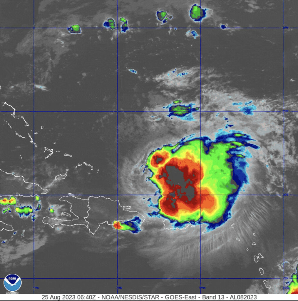
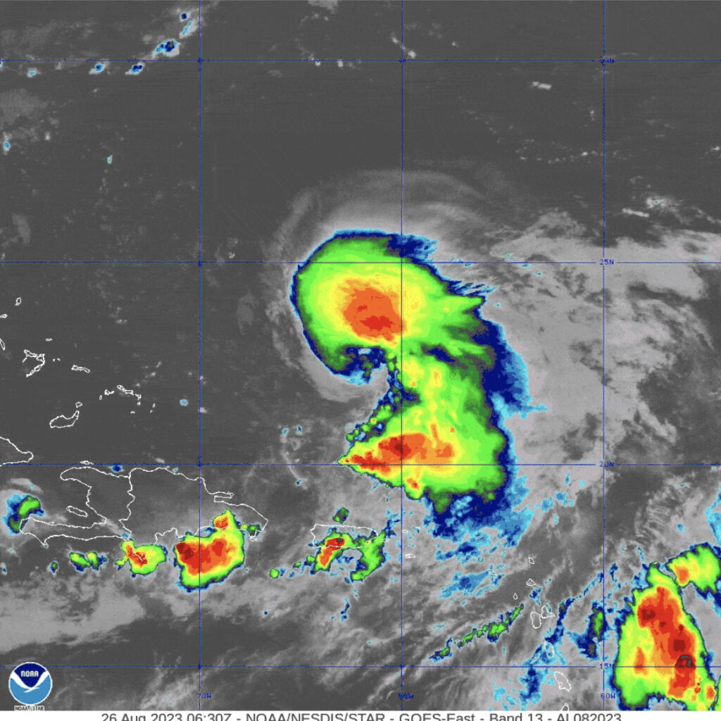
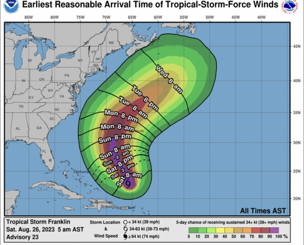
(8/26/23) Tropical Storm Franklin Discussion Number 23 NWS National Hurricane Center Miami FL AL082023 500 AM AST Sat Aug 26 2023
Franklin is gradually getting better organized. During the past couple of days, deep convection has been mainly confined to the east of the center. However, there has been a change recently with the convective pattern becoming a little more symmetric, likely due to a decrease in vertical wind shear. The Dvorak classifications from TAFB and SAB have increased to 3.5/55 kt, and the initial intensity is raised to that value.
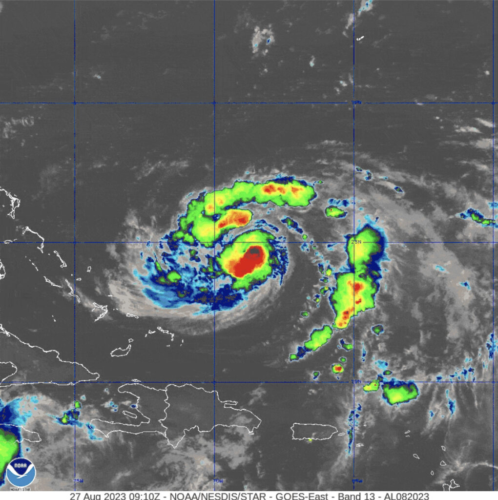
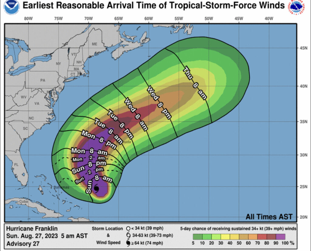
(8/27/23) Hurricane Franklin (category 1) Discussion Number 27
NWS National Hurricane Center Miami FL AL082023 500 AM AST Sun Aug 27 2023
After becoming obscured for a time earlier tonight, the eye of Franklin is beginning to re-emerge on infrared satellite images early this morning. The last helpful microwave pass at 0246 UTC showed some disruption of Franklin’s inner core that could have been due to southerly shear causing the eye-wall to be open to the east. This structure was also observed by both NOAA and Air Force Reconnaissance missions earlier tonight. Intensity estimates from SAB and TAFB were both T4.5/77 kt this morning, but with the recent re-emergence of the eye, the advisory intensity is bumped up to 80 kt for this advisory.
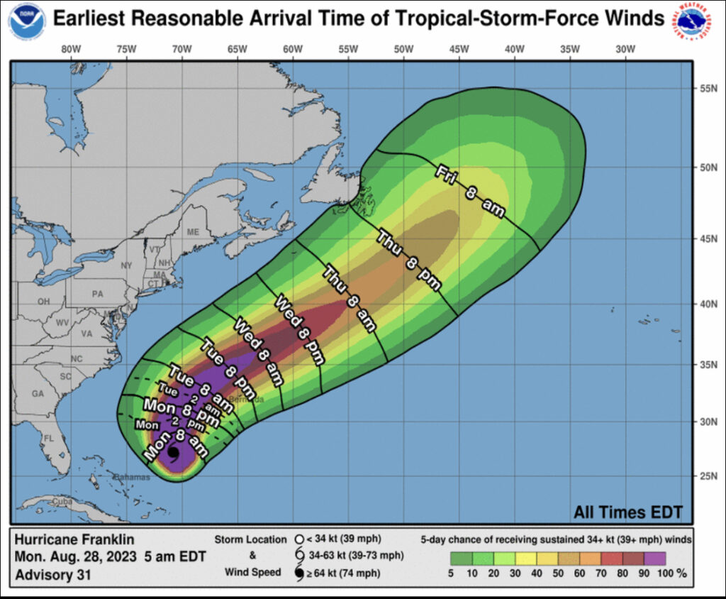
(8/28/23) Hurricane Franklin (category 4) Discussion Number 31
NWS National Hurricane Center Miami FL AL082023 500 AM EDT Mon Aug 28 2023
Franklin has continued to improve in organization during the overnight hours. The eye noted in the previous advisory has occasionally cleared out on infrared satellite imagery, with the cold eye-wall temperatures surrounding it cooling to between -65 to -75 C in a thick region around the center. Subjective Dvorak classifications were both T5.5/102 kt from TAFB and SAB, while UW-CIMSS ADT estimates are now as high as T5.7/107 kt. The initial intensity was raised to 100 kt at 06 UTC, and that will remain the intensity at 09 UTC. While this may be slightly conservative, earlier aircraft data showed that the maximum winds were lagging the satellite presentation and minimum pressure of the hurricane. This intensity still makes Franklin the first major hurricane of the 2023 Atlantic hurricane season. Another Air Force Reconnaissance mission will be in the hurricane this morning to provide an updated assessment of the storm.

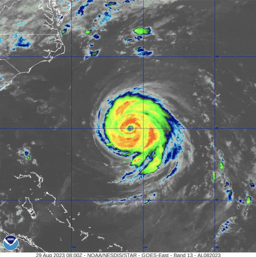
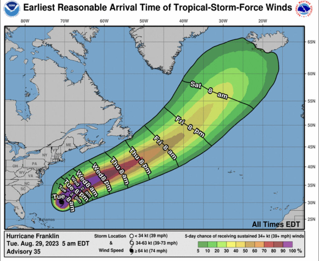
(8/29/23) Hurricane Franklin (category 4) Discussion Number 35
NWS National Hurricane Center Miami FL AL082023 500 AM EDT Tue Aug 29 2023
Near the time of the prior advisory, we received a GPM microwave pass at 0231 UTC, strongly suggesting the initial stages of an eye-wall replacement cycle (ERC) were underway. This observation is also supported by the recent trends on infrared satellite imagery, which show the coldest cloud tops relative to Franklin’s warm eye becoming more focused towards outer concentric bands seen earlier on microwave imagery. Finally, a recently received 0635 UTC AMSR2 microwave pass confirms the ERC is ongoing, with the outer eye-wall already starting to become dominant on the 89-GHz channel. All this data means is that the hurricane is likely past its peak intensity, but may be broadening its inner-core wind field as it undergoes this structural change. Subjective final T-number intensity estimates were 6.0/115 kt from both TAFB and SAB, with UW-CIMSS ADT also at T6.0/115 kt. However since the earlier aircraft data showed that Franklin was stronger than the satellite signature would suggest, the initial intensity is only being lowered to 120 kt for this advisory.
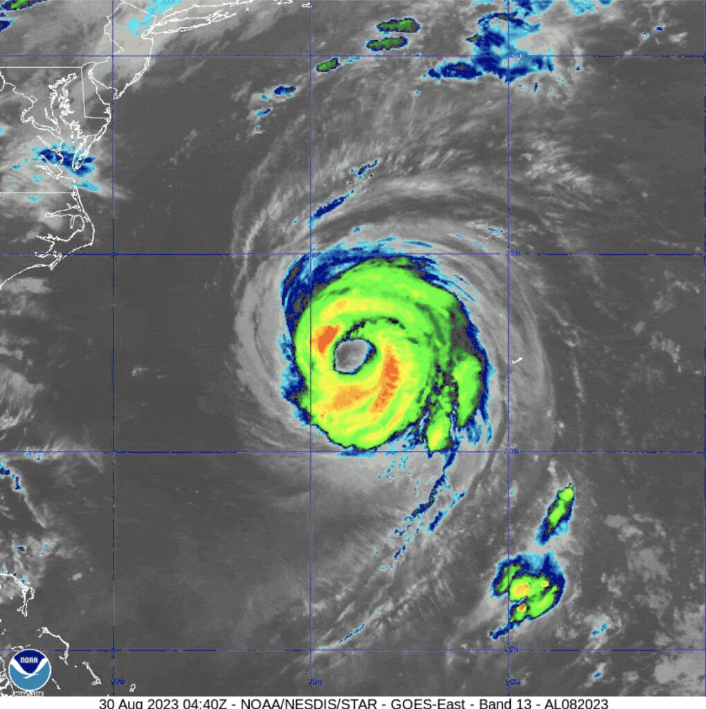
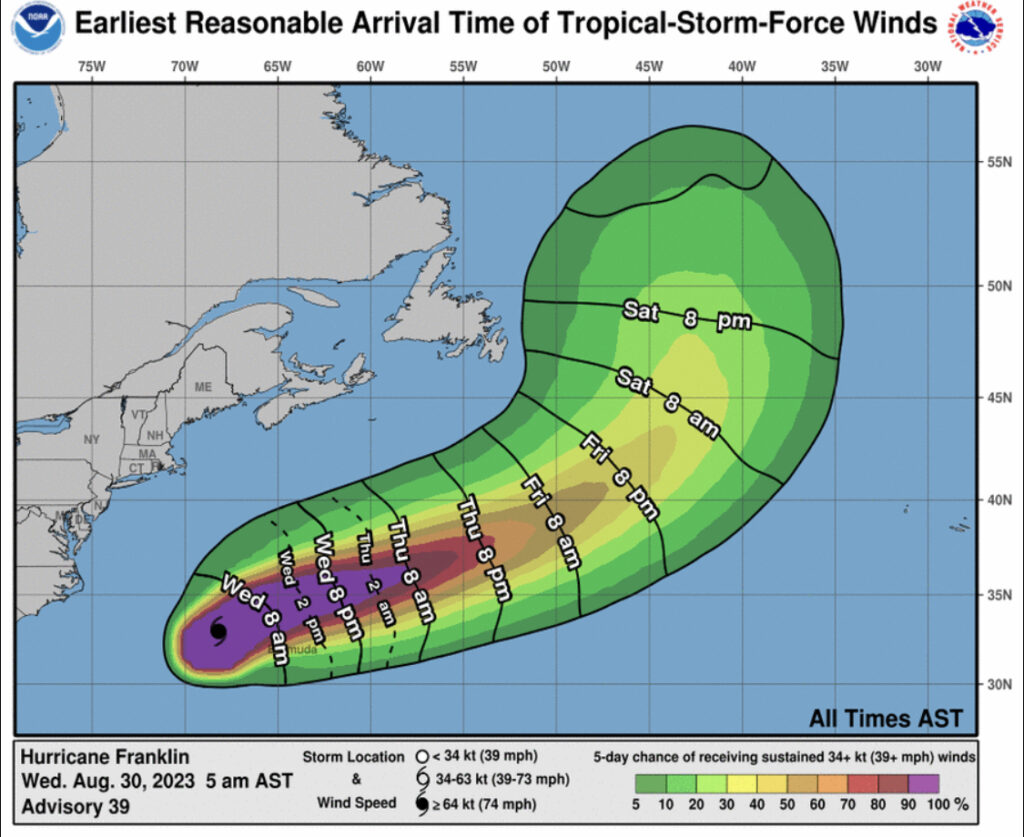
(8/30/23) Hurricane Franklin Discussion Number 39
NWS National Hurricane Center Miami FL AL082023 500 AM AST Wed Aug 30 2023
Franklin has a large eye this morning since completing its eye-wall replacement cycle yesterday. The estimated diameter from satellite data is about 50 n mi. With that said, there are some subtle signs that vertical wind shear over the system has begun to increase. The hurricane’s outflow has become restricted in the western side of the storm, related to the outflow of Idalia spreading quickly towards it. Intensity estimates have been gradually decreasing, and the initial intensity was lowered to 95 kt this advisory. This intensity lies roughly in between the higher TAFB and lower SAB subjective estimates, and is very close to the most recent ADT and D-MINT estimates provided by UW-CIMSS.
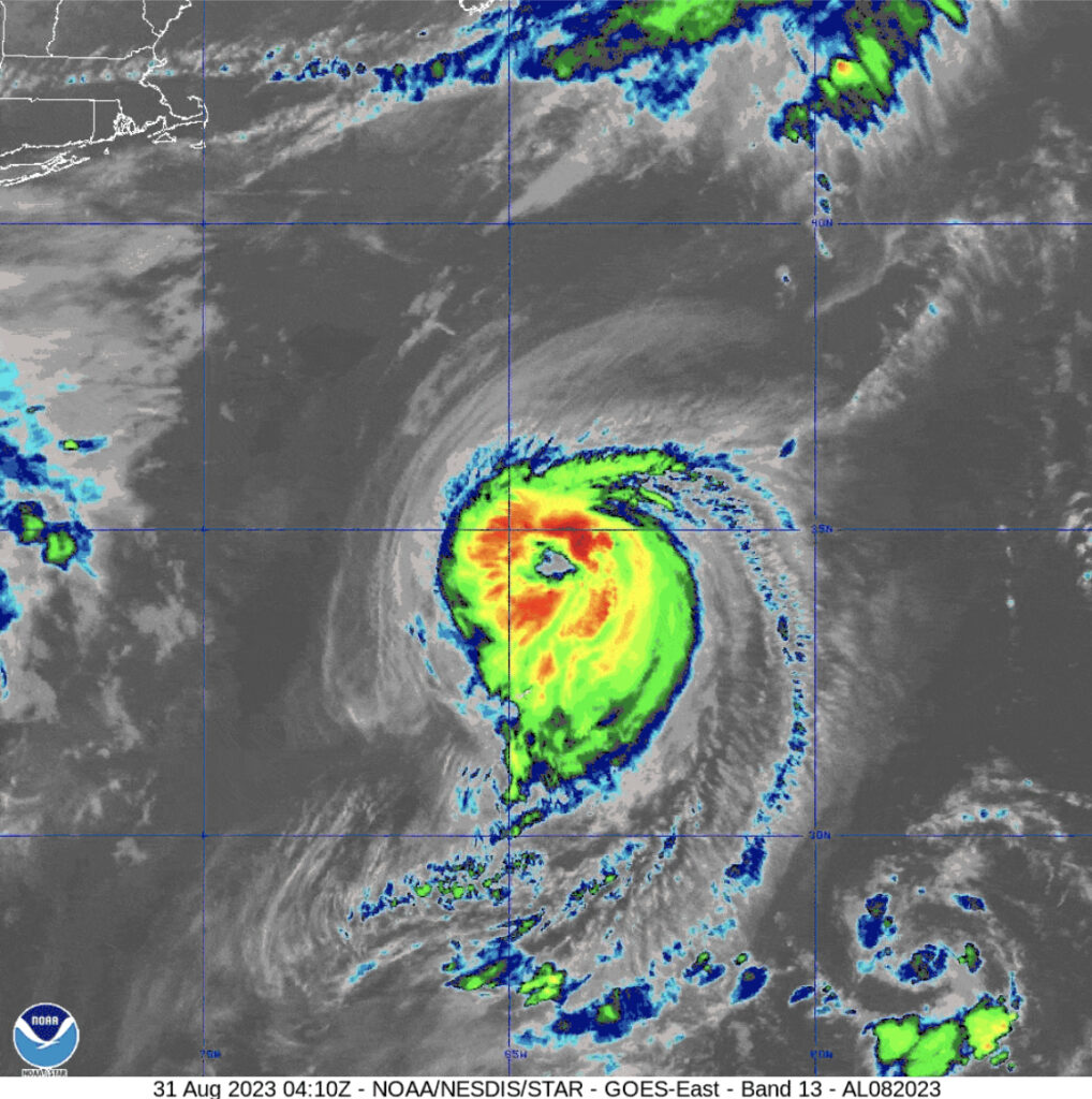
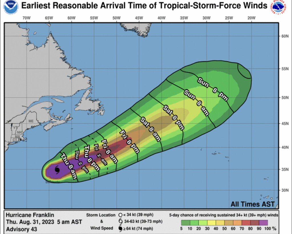
(8/31/23) Hurricane Franklin Discussion Number 43
NWS National Hurricane Center Miami FL AL082023 500 AM AST Thu Aug 31 2023
Franklin continues to slowly succumb to the increasingly unfavorable conditions the large hurricane is embedded in. The large eye that had been evident over the last day or so is no longer observed on infrared satellite imagery, likely due to 25-30 kt of northerly shear affecting the convective structure which now favors the southern side of the storm. This observation is also consistent with the radar reflectivity returns from the Bermuda radar. With that said, both the subjective and objective intensity estimates this morning still support an intensity in the 85-90 kt range. Thus Franklin’s intensity will remain 85 kt this advisory, though this may be generous.
Leave a Reply