
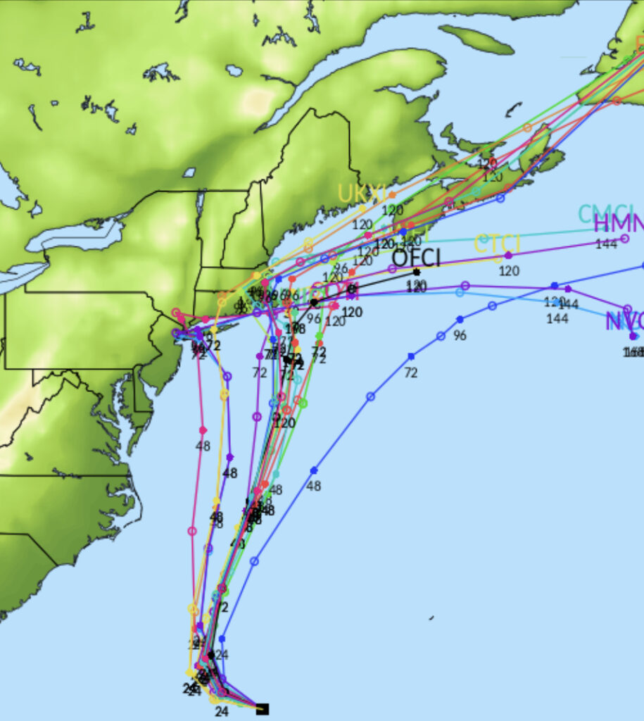
Henri – to strengthen into a Cat 1 Hurricane
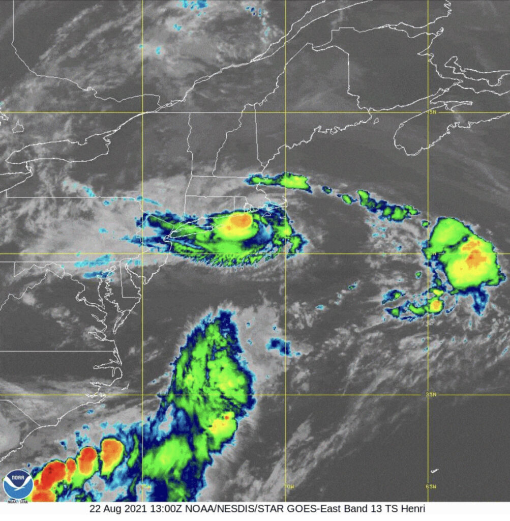
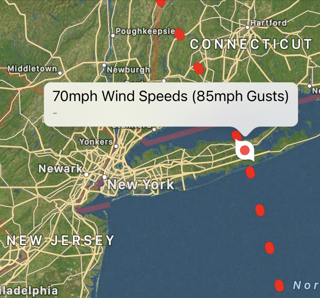
11:00 AM Sunday, August 22nd, 2021 – Henri’s presentation in both satellite and radar imagery has degraded significantly since the previous advisory due to the cyclone moving over much cooler waters. An eyewall feature is no longer evident.
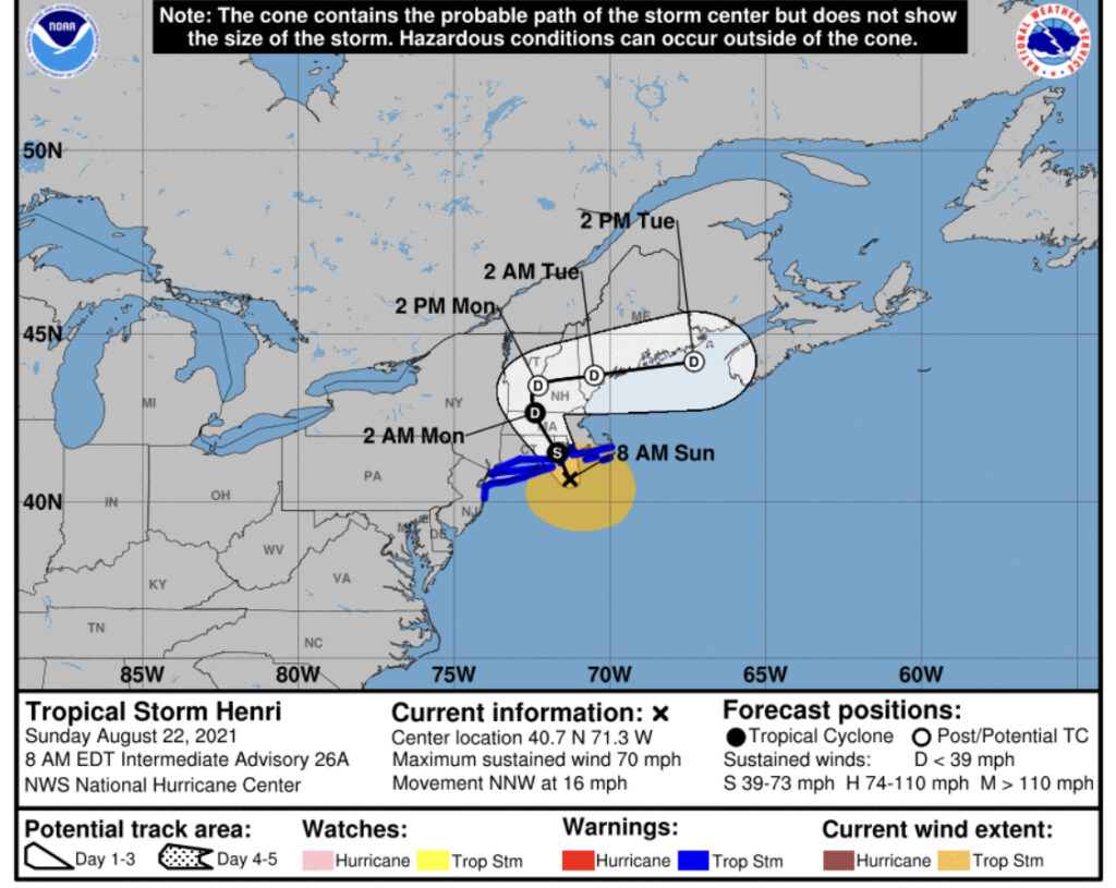
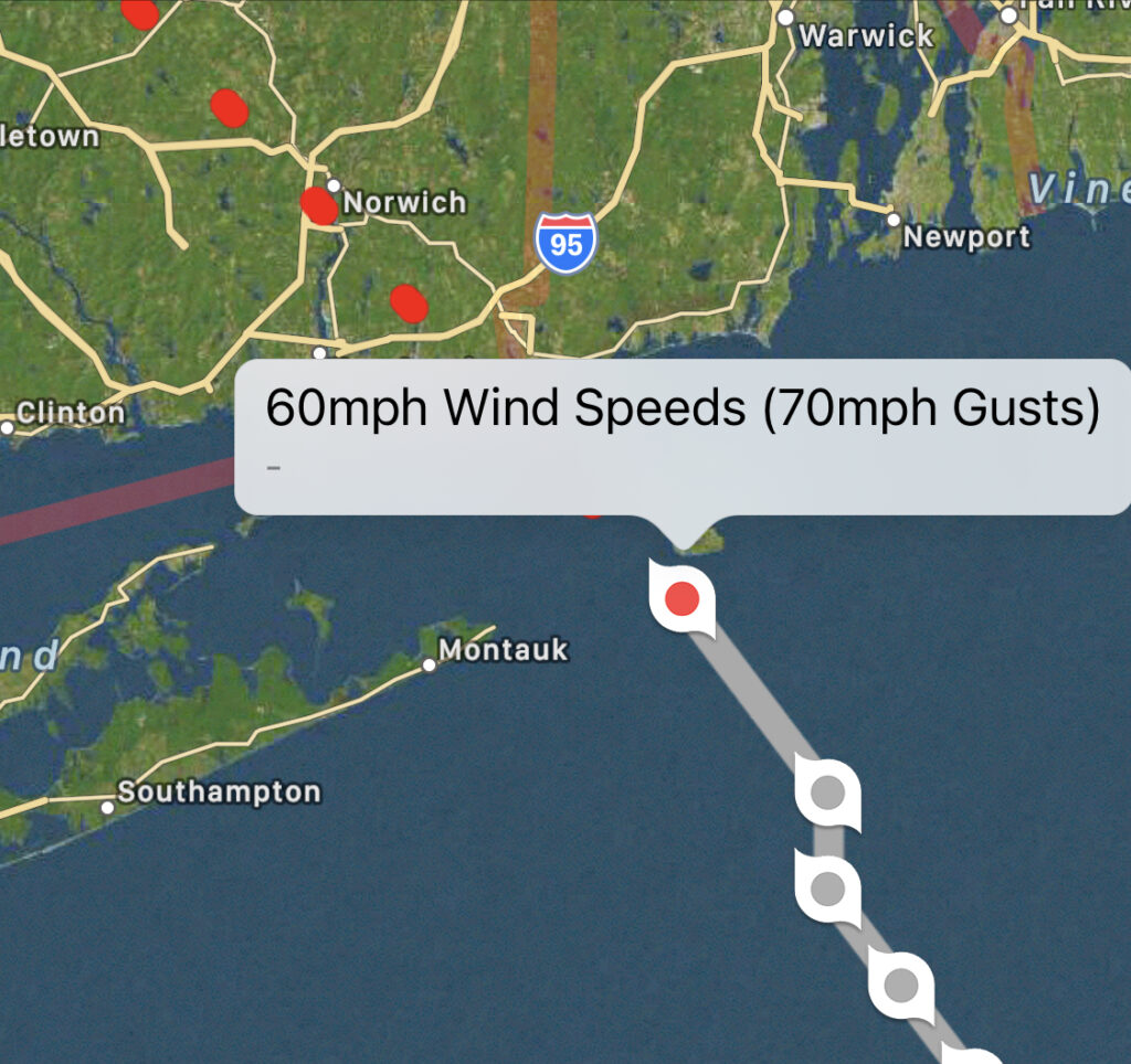
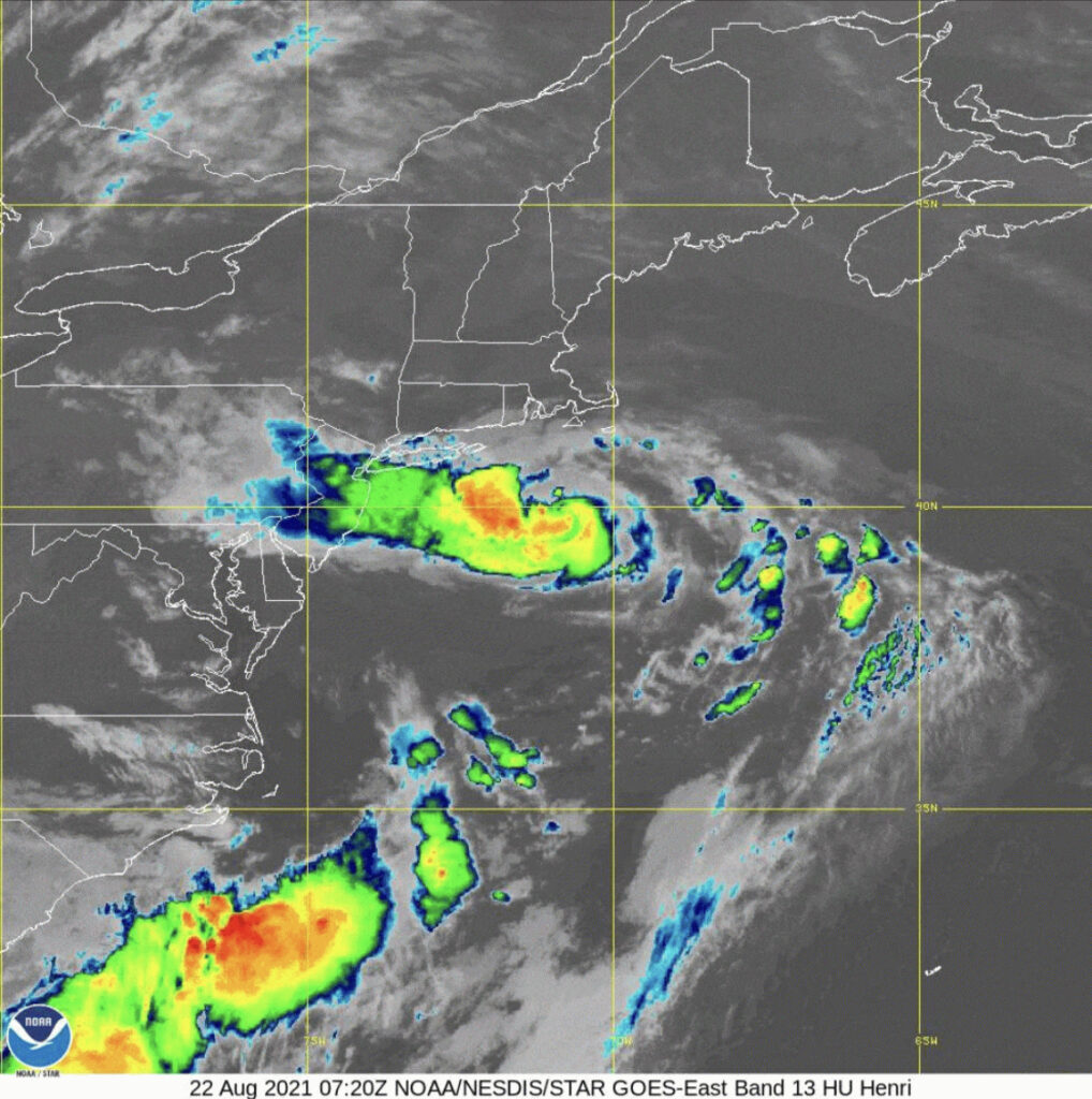
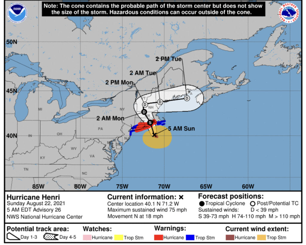
5:00 AM Sunday, August 22nd, 2021 – Henri’s satellite presentation has remained largely unchanged overnight and early this morning. The storm is expected to move north-northeastward today missing Long Island. Henri is expected to pass just East of Block Island and will encounter cooler waters on its approach to New England.
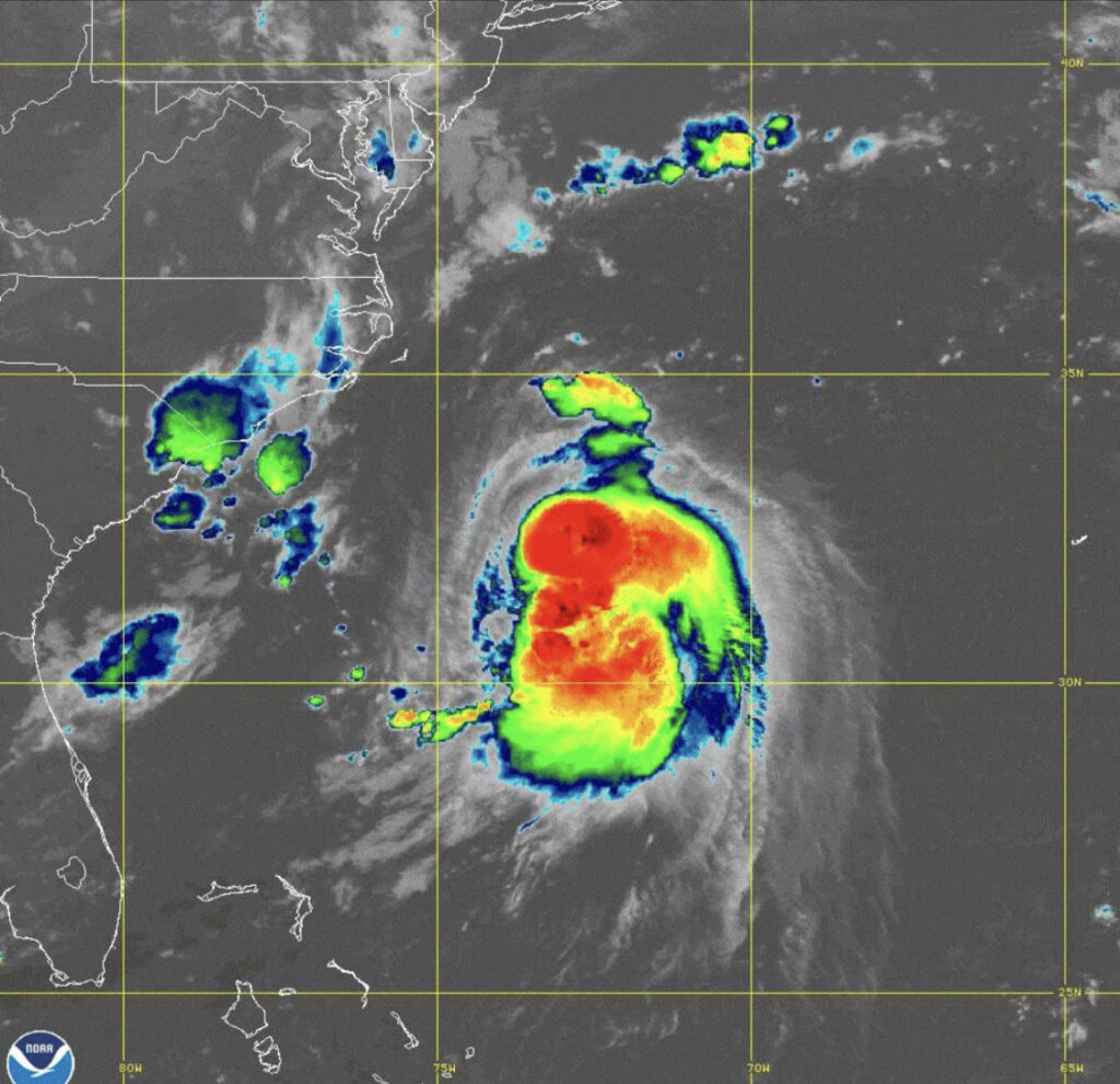
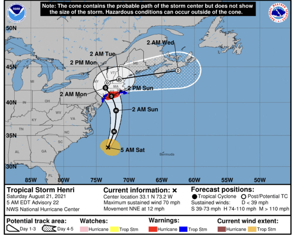
5:00 AM Saturday, August 21st, 2021 – An earlier GMI satellite microwave image continued to indicate that Henri’s low-level center was still located near the northwestern edge of the convective canopy. Henri is moving north-northwestward or 015/10 kt. This motion will bring the center of Henri near or over portions of Long Island and Southern New England on Sunday and into the northeastern US Sunday night.
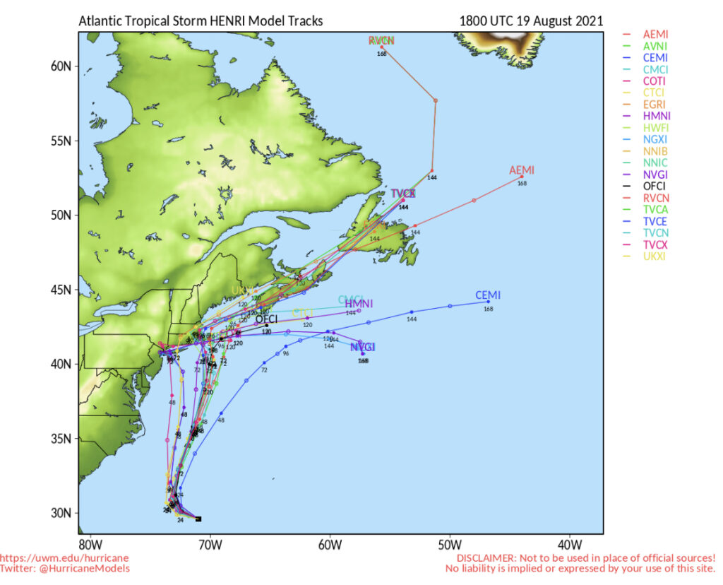
11 AM EDT Friday August 20th, 2021 – The Air Force Reserve Hurricane Hunters investigated Henri this morning and based on flight level SFMR and dropsonde data, the initial intensity is still at 55kt. The initial motion still appears to be northwestward at 6kt.
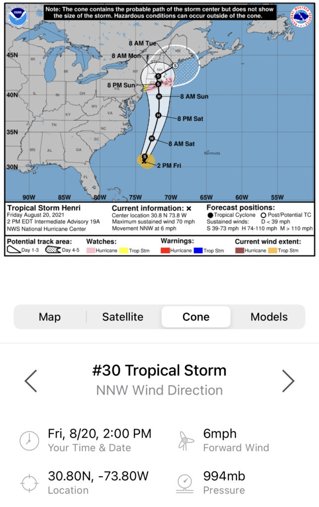
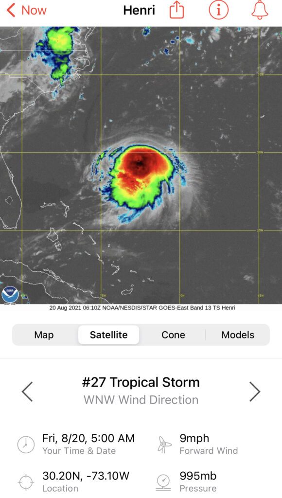
5:00 AM EDT Friday August 20th, 2021 – Henri’s low-level center has been peaking out from under the north side of the deep convection mass, resulting from continued 20-25 kt of northerly shear. Maximum winds are still estimated to be 55 kt based on T3.5 Dvorak estimates from TAFB and SAB. A shortwave through current over the center Appalachians is forecast to close off by Saturday, with Henri accelerating northward on the east side of this feature through the weekend.

Leave a Reply