
Hurricane Cat 4 – Gabrielle
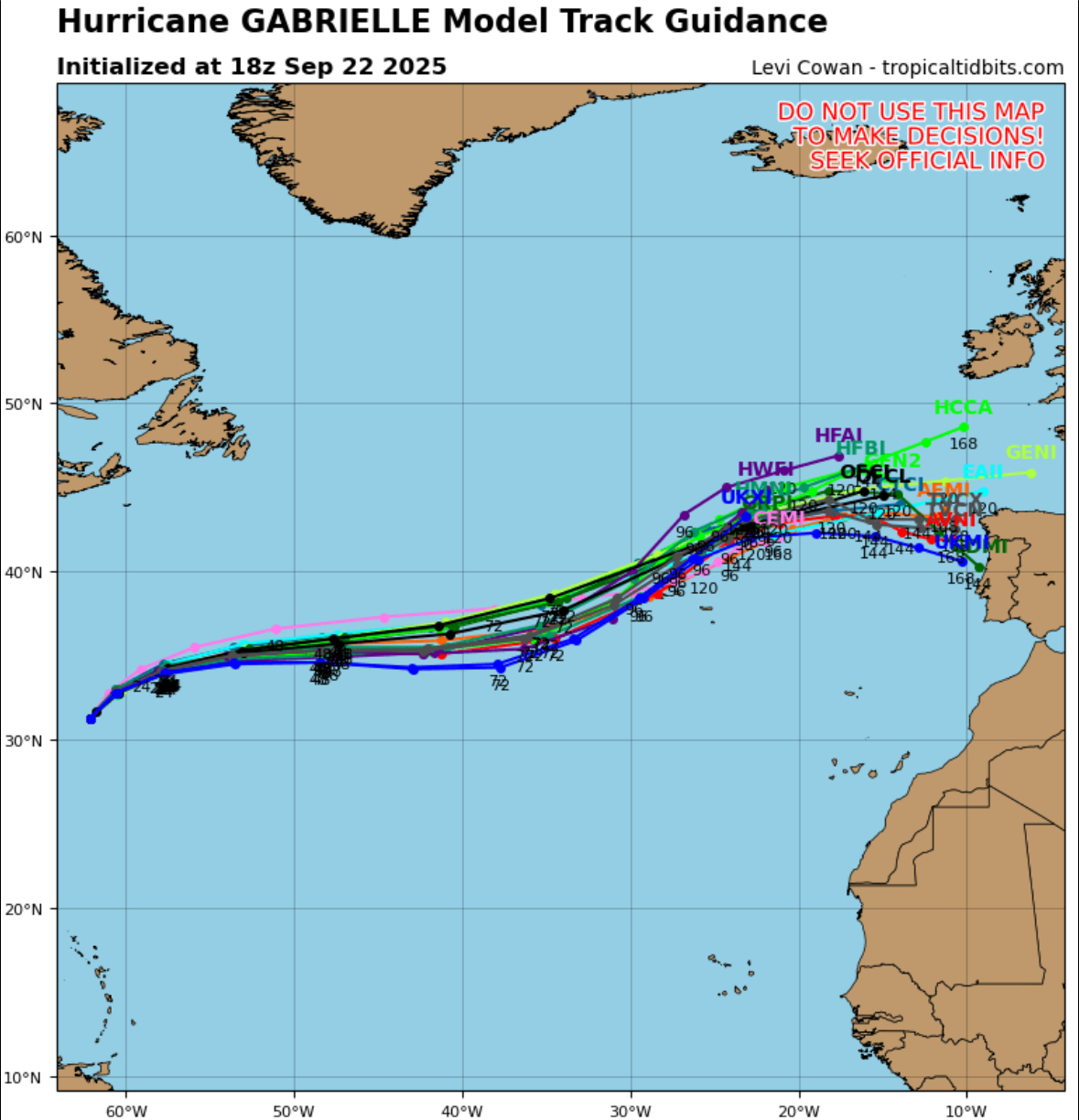
As of 8 PM AST on September 23, 2025, Hurricane Gabrielle, a Category 3 storm with sustained winds of 125 mph, is located 580 miles east-northeast of Bermuda and 1,575 miles west of the Azores, moving ENE at 21 mph. A Hurricane Watch is in effect for all of the Azores, where Gabrielle is expected to bring hurricane conditions by Thursday night. Although weakening is expected, Gabrielle will likely remain a hurricane as it crosses the islands. The storm may cause coastal flooding, large waves, and 3–5 inches of rainfall in the central and western Azores, with dangerous surf continuing elsewhere.


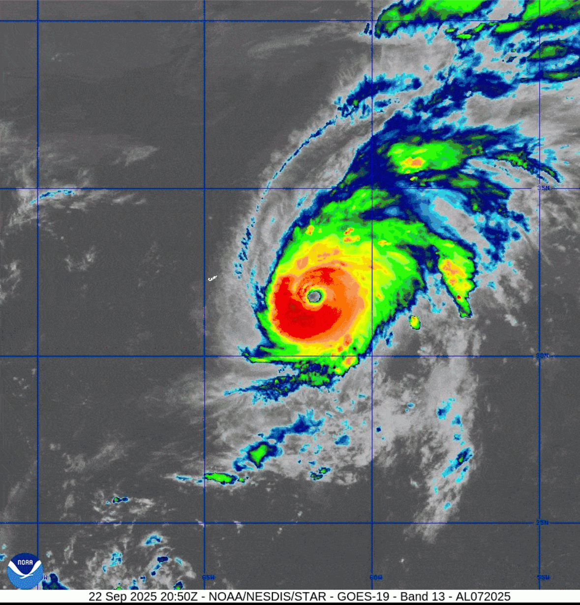
As of 5:00 PM AST on September 22, 2025, Hurricane Gabrielle has strengthened into a powerful Category 4 hurricane with maximum sustained winds of 140 mph. Located about 180 miles east-southeast of Bermuda, Gabrielle is moving north-northeast at 12 mph. The storm is expected to pass east of Bermuda tonight and turn northeastward by Tuesday. Although no coastal warnings are currently in effect, interests in the Azores should closely monitor the storm. Swells from Gabrielle are affecting Bermuda, the U.S. East Coast, and Atlantic Canada, producing dangerous surf and rip currents. Gradual weakening is forecast over the next two days.

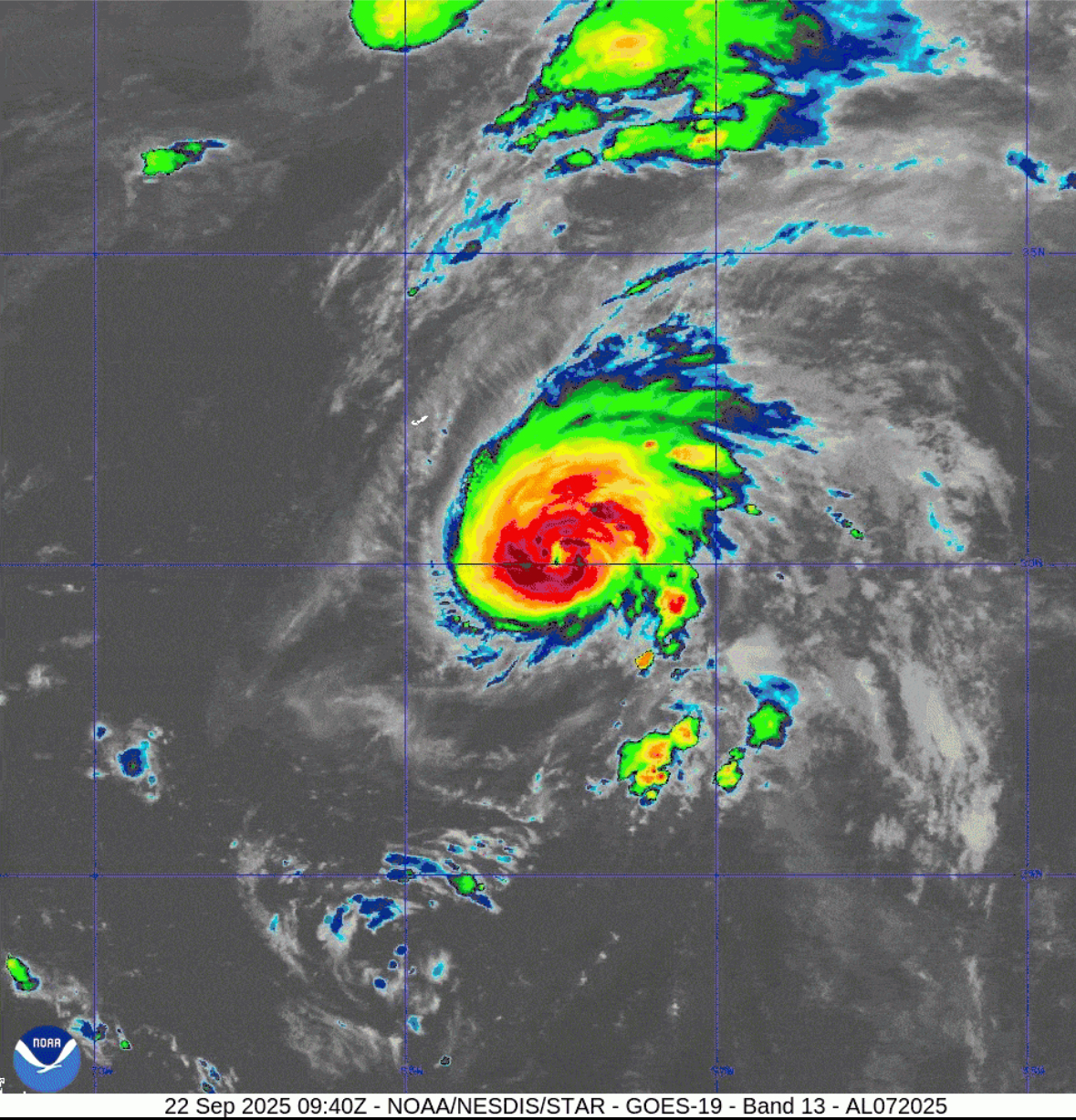
As of 5 AM AST on September 22, 2025, Hurricane Gabrielle has strengthened, with maximum sustained winds of 90 mph and a minimum central pressure of 978 mb. Located about 210 miles southeast of Bermuda, Gabrielle is moving north-northwest at 10 mph and is expected to pass east of Bermuda tonight. No coastal watches or warnings are in effect, but Bermuda residents should monitor updates. The storm may become a major hurricane within the next day. Swells from Gabrielle are impacting Bermuda, the U.S. East Coast, and Atlantic Canada, potentially causing life-threatening surf and rip currents. Further updates are expected


Leave a Reply