
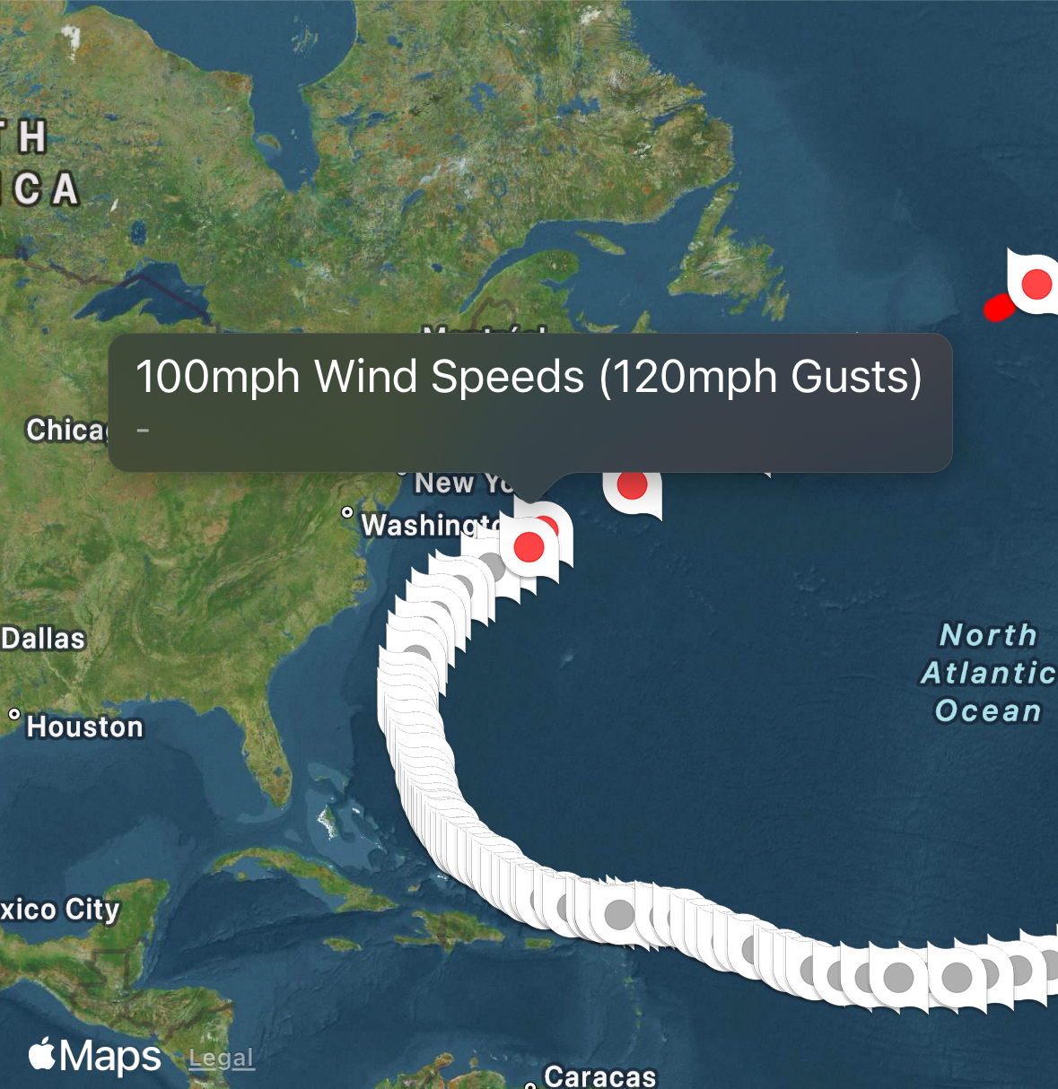
Hurricane Cat 5 – Erin
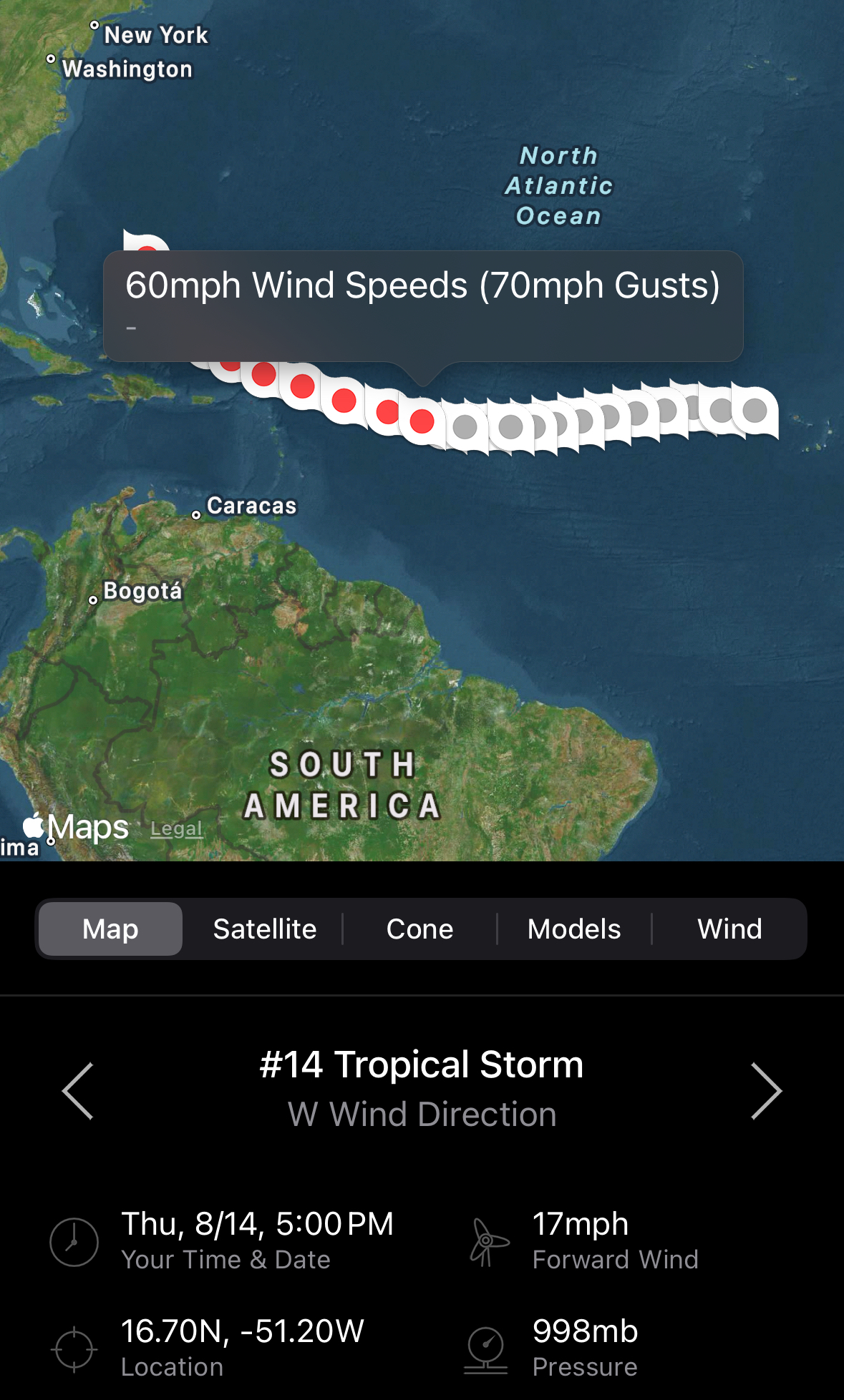
8/14/25 @ 5 PM.
Tropical Storm Erin, located 790 miles east of the northern Leeward Islands, has sustained winds of 60 mph and is moving west at 17 mph. Tropical Storm Watches are in effect for several islands. Erin is expected to strengthen into a hurricane by Friday, bringing heavy rain, strong winds, and dangerous surf.
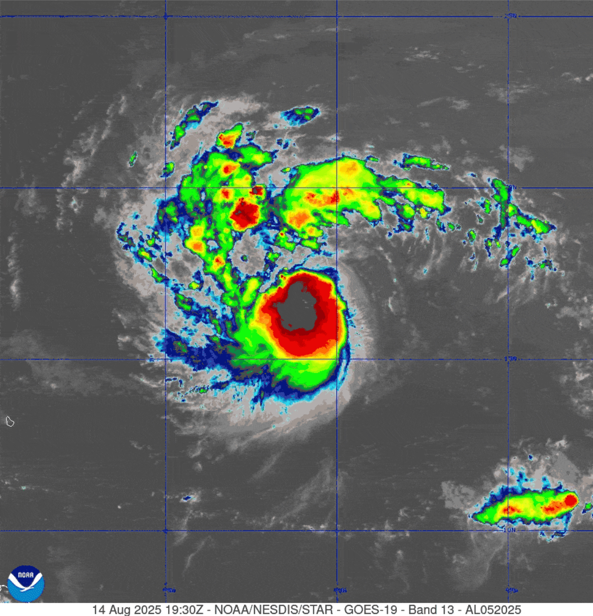

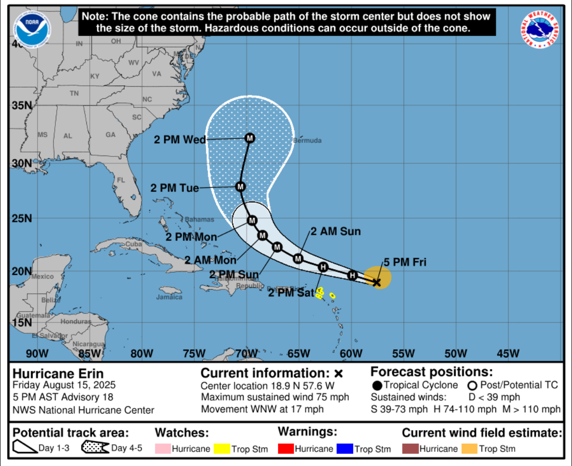
8/15/25 @ 5 PM
Hurricane Erin, a Category 1 storm with 75 mph winds, is moving west-northwest at 17 mph and expected to strengthen into a major hurricane this weekend. Its center will likely pass just north of the northern Leeward Islands, Virgin Islands, and Puerto Rico, with hurricane-force winds extending 25 miles from the center.
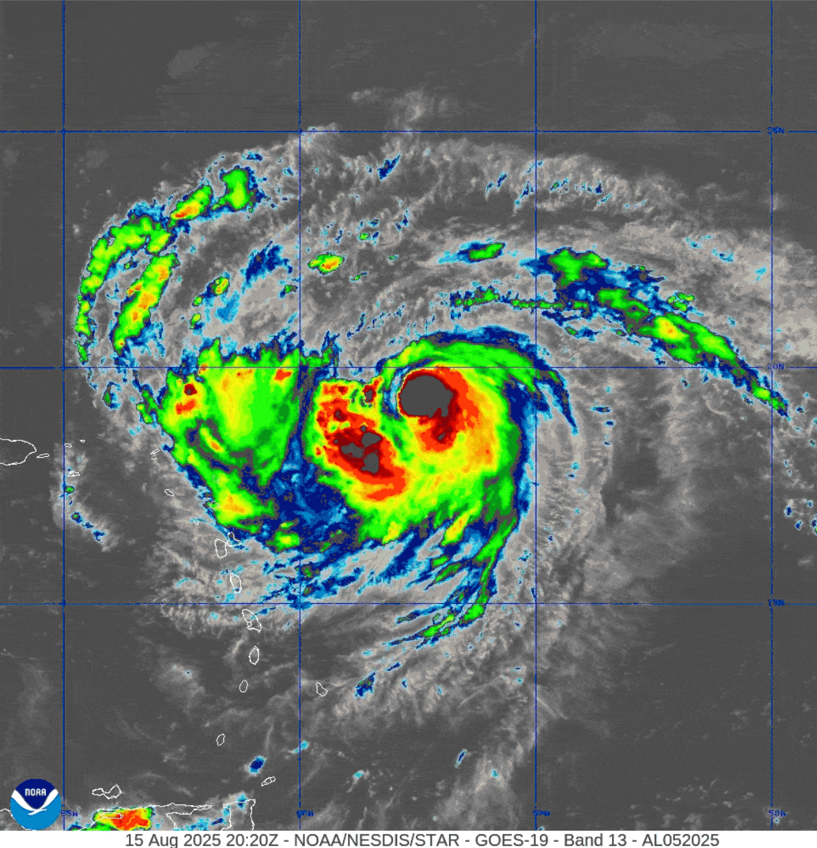
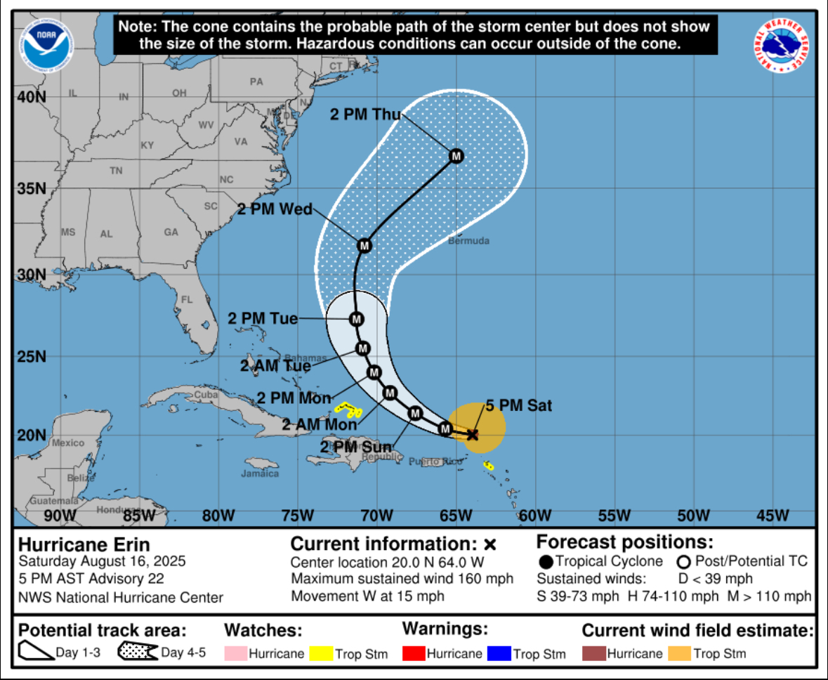
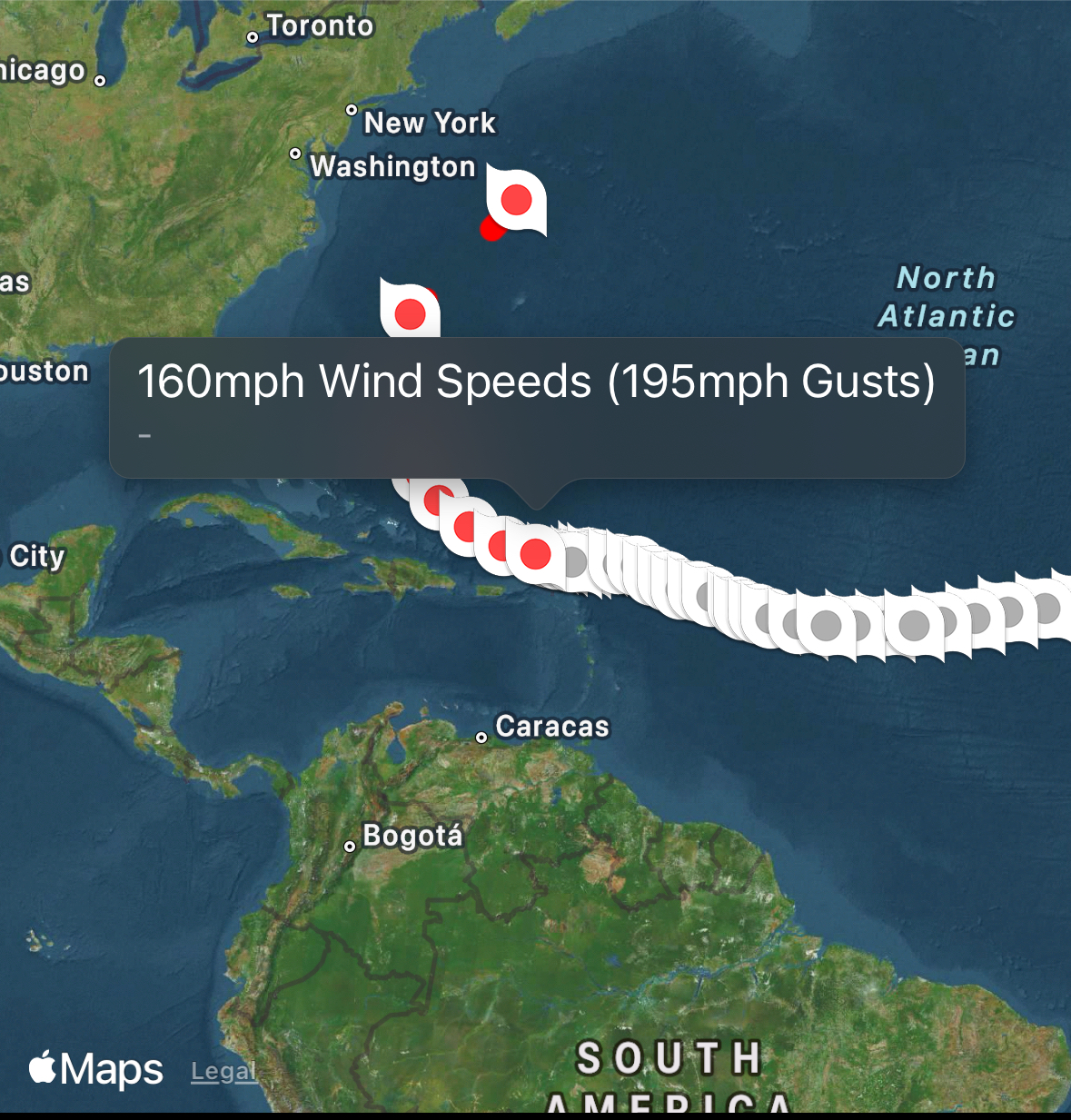
8/16/25 @ 5PM
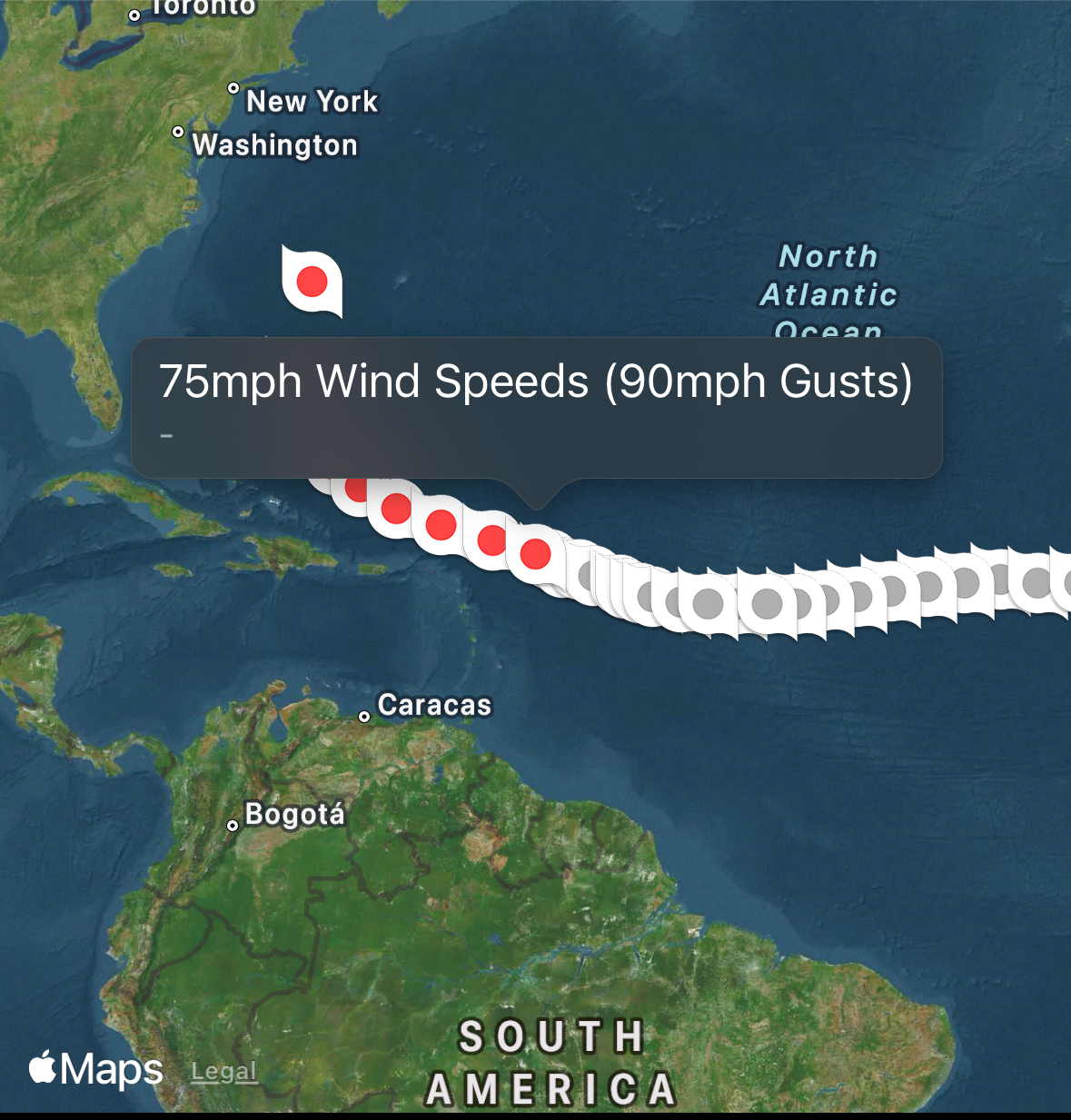
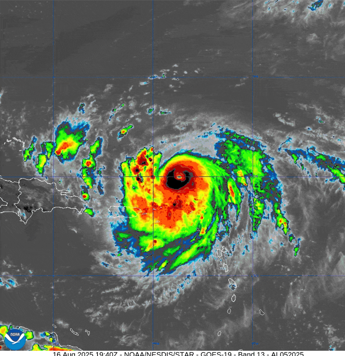
Hurricane Erin, a Category 5 storm was located near 18.9°N, 57.6°W, moving west-northwest at 17 mph. With sustained winds of 160 mph and higher gusts at 195 mph. The storm is forecast to pass just north of the Leeward Islands, Virgin Islands, and Puerto Rico.
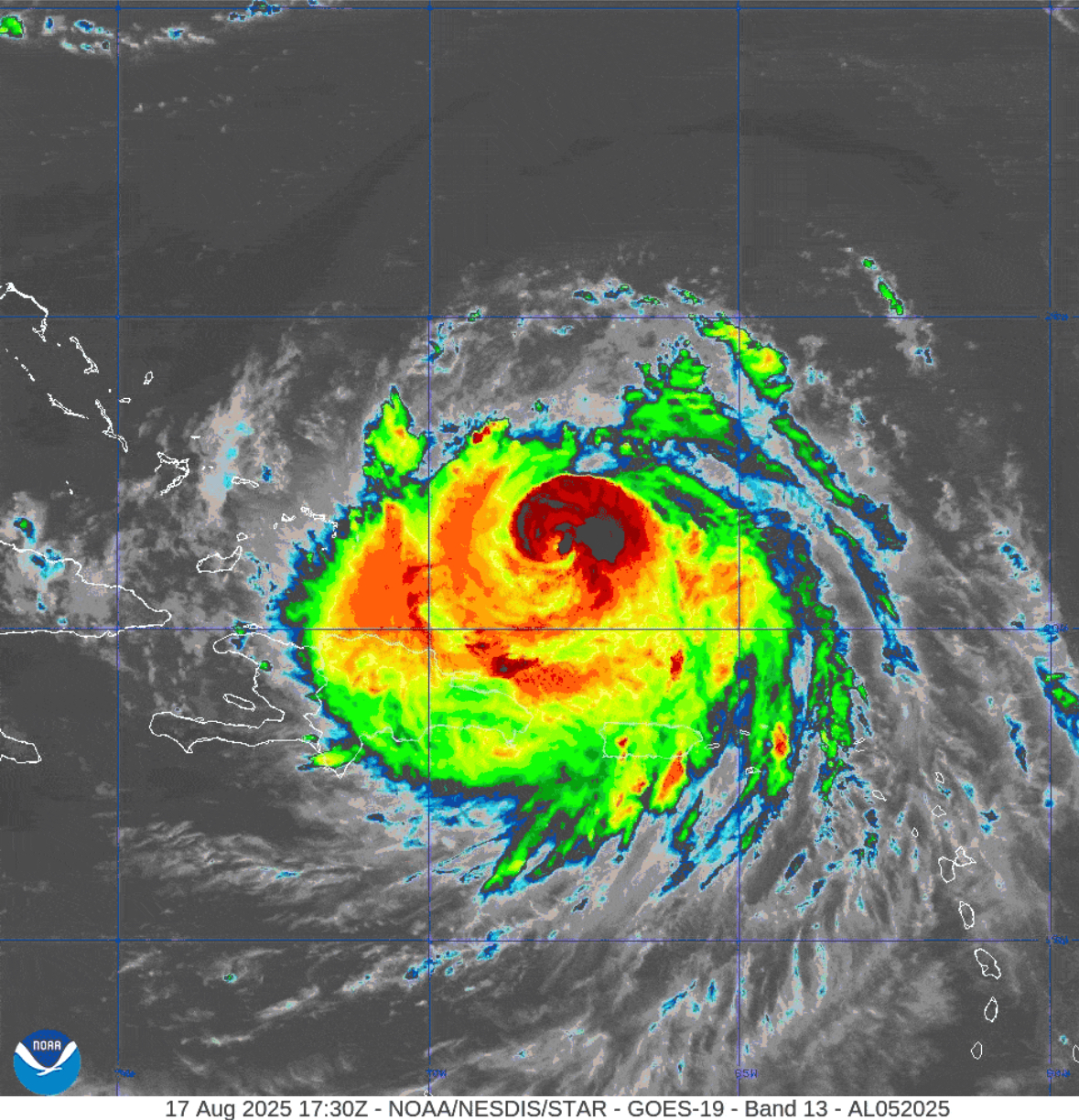
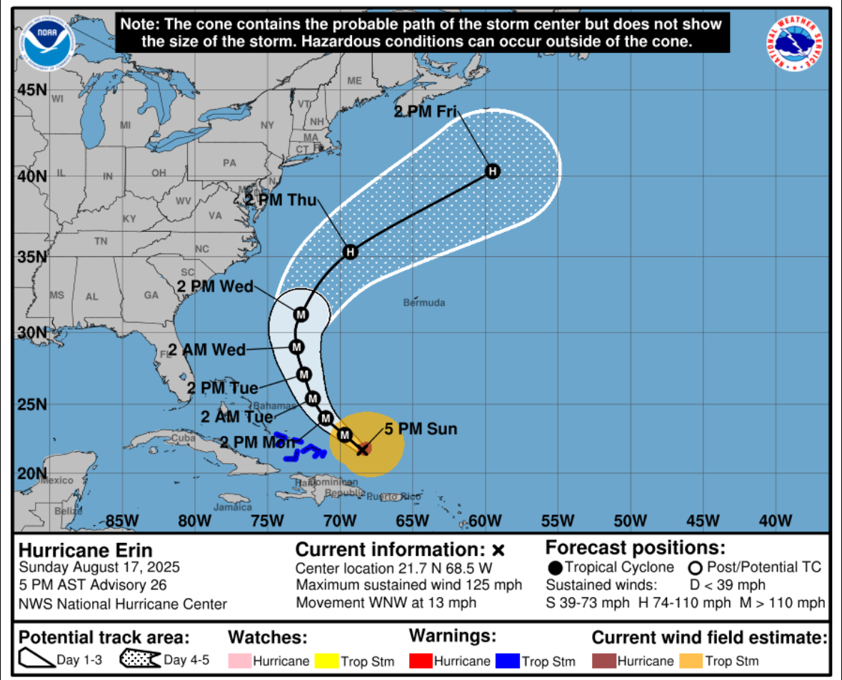
8/17/25 @ 5 PM
Hurricane Erin, a Category 3 storm with 125 mph winds, is moving west-northwest near the Turks and Caicos. It’s expected to intensify and grow in size. Tropical storm warnings are active, with heavy rain, flooding, and dangerous surf likely. Erin may remain a major hurricane through midweek as it tracks northward.
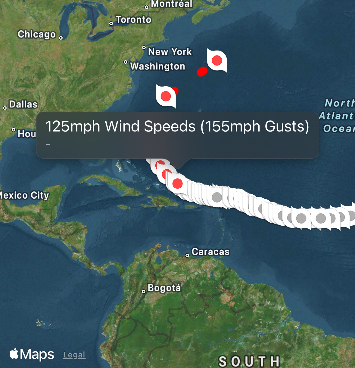
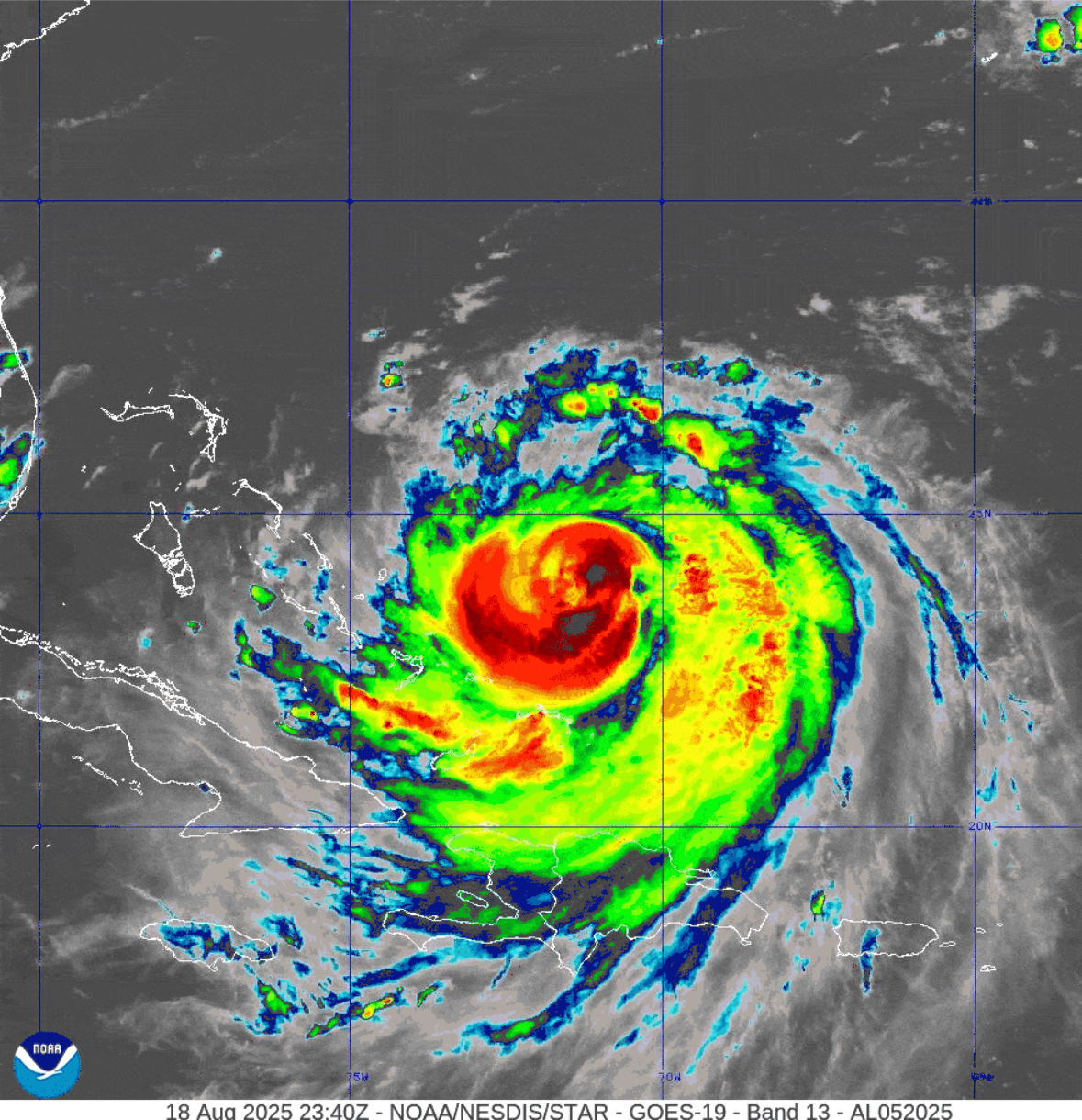
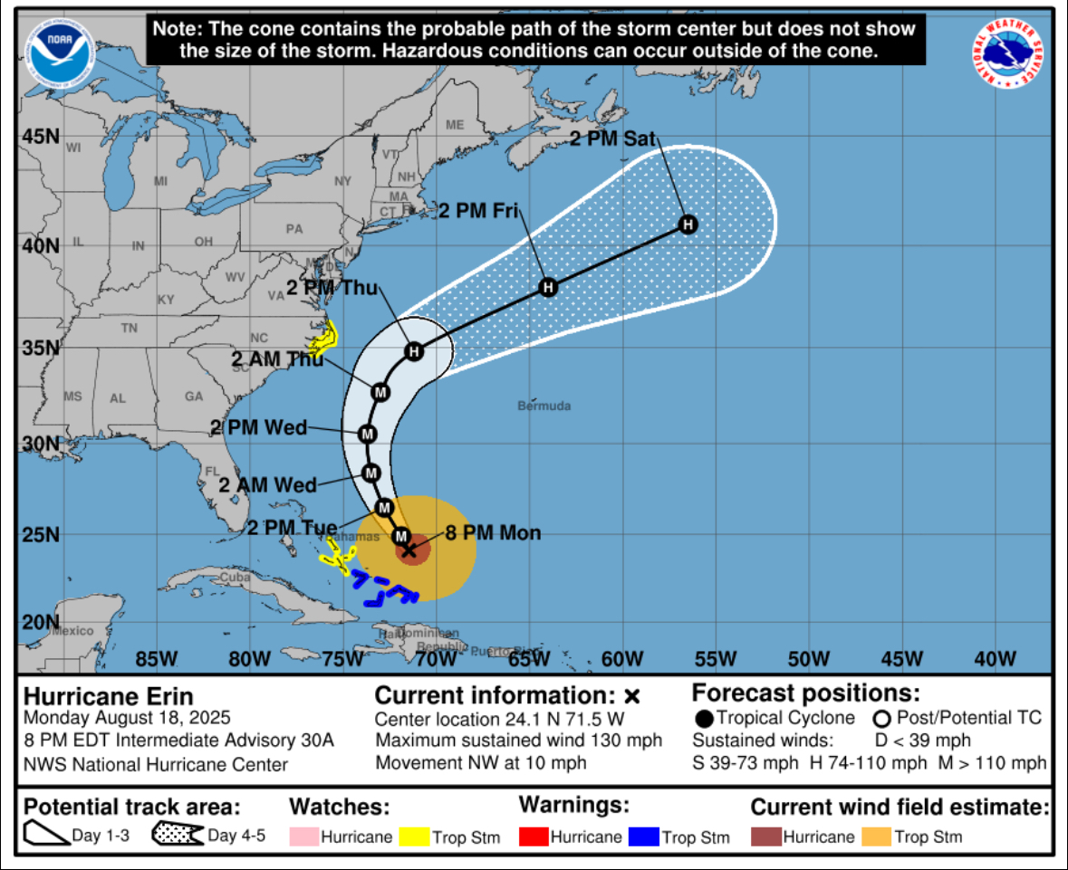
8/18/2025 @ 8 PM
Hurricane Erin, a Category 4 storm with sustained winds of 130 mph, is located east of the Bahamas and moving northwest at 10 mph. It is expected to pass between Bermuda and the U.S. East Coast midweek. Tropical Storm Warnings are in effect for parts of the Bahamas, with watches along North Carolina’s coast. Dangerous surf, heavy rain, and storm surge are anticipated.
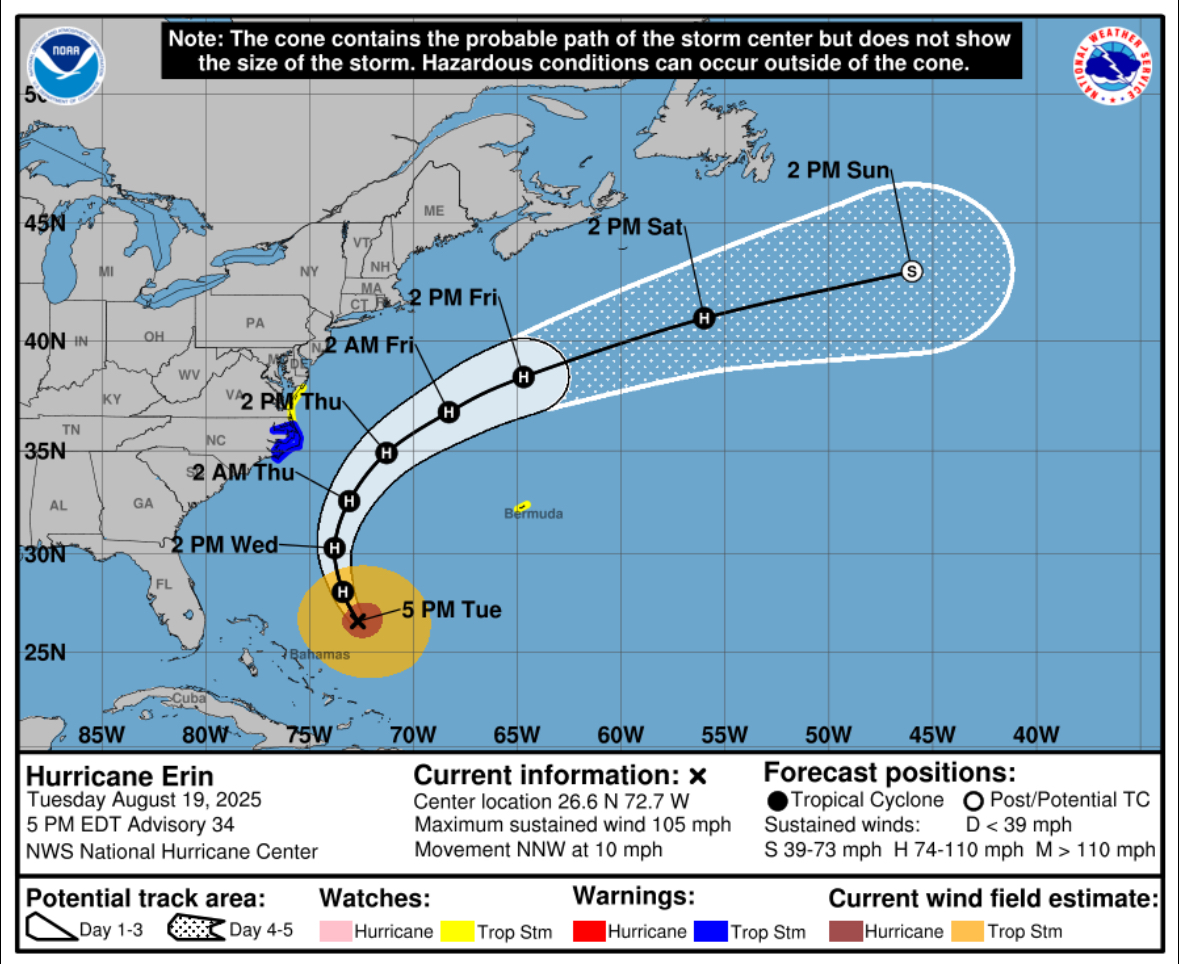
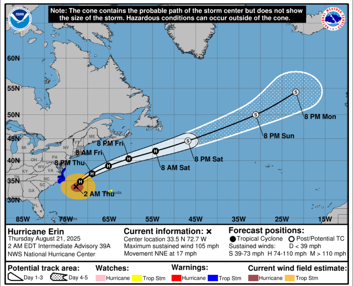
8/19/2025 @ 5 PM
Hurricane Erin remains a strong storm with 105 mph winds, located about 615 miles southwest of Bermuda. It is moving north-northwest at 10 mph and is expected to pass between the U.S. East Coast and Bermuda. Tropical Storm Watches and Warnings are in effect along parts of the U.S. East Coast and Bermuda. Life-threatening rip currents, storm surge, and heavy rain are forecast.
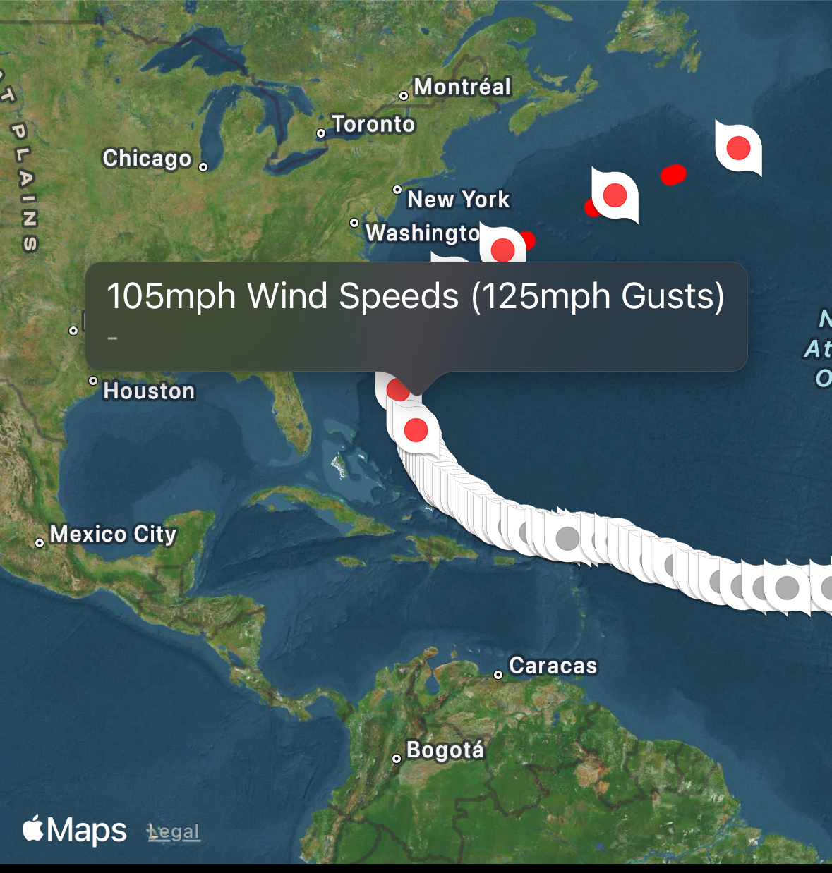


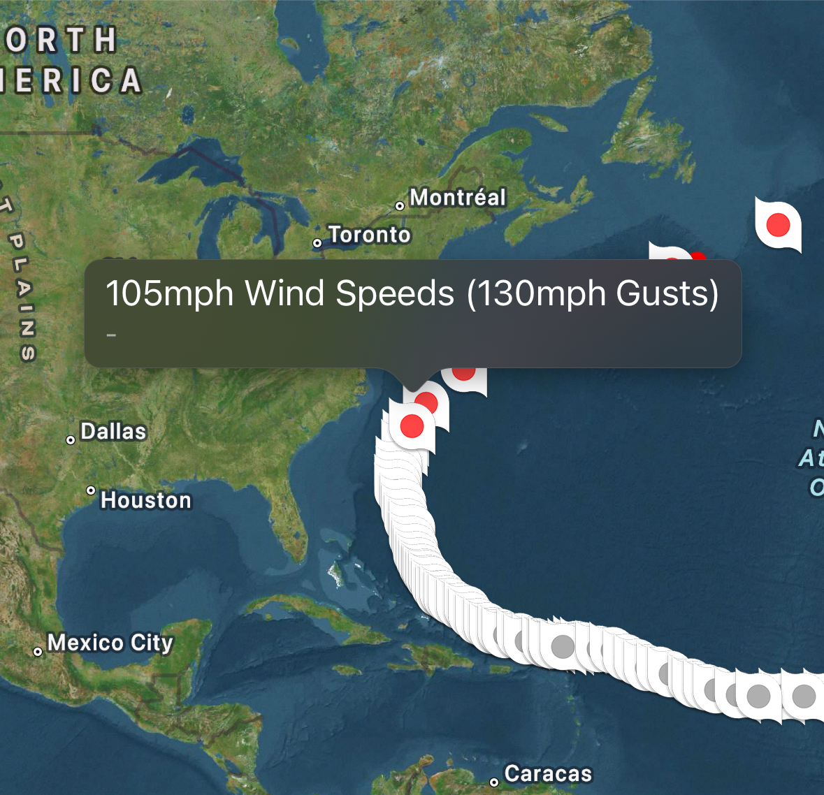
8/20/2025 @ 10 PM
Hurricane Erin, with sustained winds of 105 mph, is located about 200 miles southeast of Cape Hatteras, NC, moving north-northeast at 17 mph. Tropical storm conditions are impacting the Outer Banks, with warnings issued for parts of North Carolina and Virginia. Dangerous surf and rip currents threaten much of the U.S. East Coast. Erin is expected to weaken and become post-tropical by Saturday.
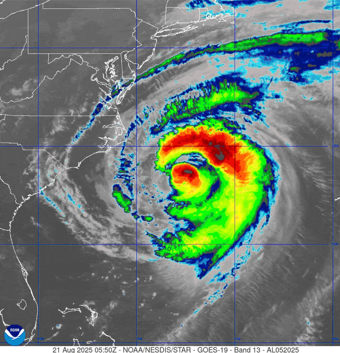


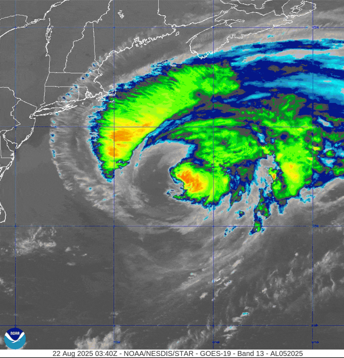
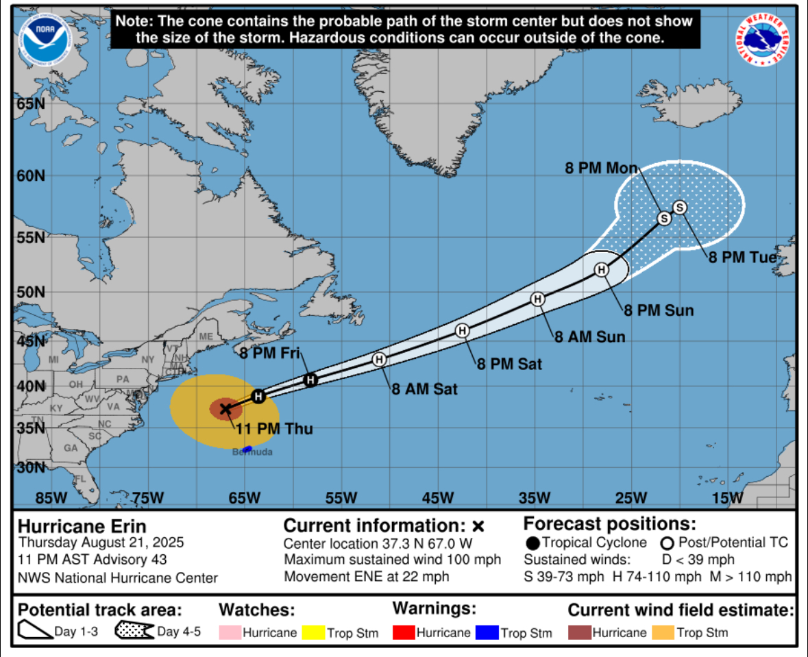
8/21/25 @ 10 PM
Hurricane Erin, with sustained winds of 100 mph, is moving east-northeast between New England and Bermuda. While weakening is expected, Erin remains a large storm, with tropical-storm-force winds extending 320 miles from its center. Bermuda is under a Tropical Storm Warning, and coastal areas from the U.S. to Atlantic Canada face dangerous surf and rip currents. The storm may become post-tropical by Saturday. Storm surge impacts are gradually receding.
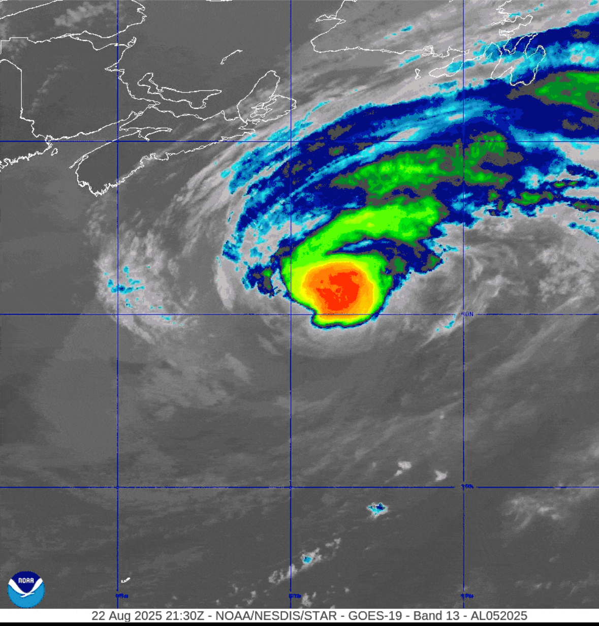
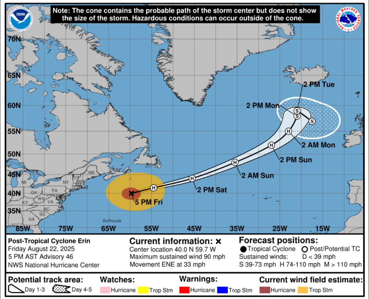
8/22/25 @ 7 PM
Post-Tropical Cyclone Erin, now located southeast of Halifax, Nova Scotia, is moving rapidly east-northeast with sustained winds of 90 mph. Although no coastal warnings are in effect, dangerous surf and rip currents will impact the U.S. East Coast, Bermuda, the Bahamas, and Atlantic Canada through the weekend. Erin is expected to remain a powerful system as it moves across the North Atlantic. This is the final advisory from the National Hurricane Center.


Leave a Reply